
News Desk | October 30: Flooding from Bhutan’s Shintaphu Lake in Gasa district has washed away a section of the road to Laya, cutting off the remote settlement from the rest of the country. Local residents have reportedly been moved to safer locations, while precautionary measures have been taken at the Punatsangchhu-II hydropower project. The incident has raised concerns about possible downstream effects in lower Assam, although the impact on the region remains unconfirmed.
Floodwaters Pass Through Taktshimakhang at Around 8:15 PM
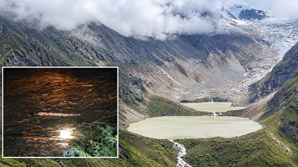
According to BBS, Shintaphu Lake is located below Wakila Mountain in the Lungo area of Laya Gewog in Gasa district. Flooding from the lake was reported on Thursday evening, following which local residents were reportedly moved to safer locations.
In a subsequent update, BBS reported that floodwaters passed through Taktshimakhang at around 8:15 PM. The extent of the damage could not be assessed immediately because of darkness. No human casualties had been reported at the time of the update.
Punatsangchhu-II Hydropower Project Takes Precautionary Measures
BBS reported that the generating units at the Punatsangchhu-II hydropower project were shut down and dam gates were opened as a precautionary measure.
Citing the project’s Joint Managing Director, Rinzin Gyeltshen, BBS said the floodwaters were expected to carry large quantities of logs, branches and other floating debris. Such material could damage project infrastructure and potentially block intake tunnels.
The measures were taken to allow floodwaters and debris to pass safely and reduce the risk of damage to critical installations.
BBS also reported that army personnel stationed at Taktshimakhang, staff at the project office and people at Gasa Tsachu were instructed to move to safer locations.
Road Connectivity to Laya Disrupted
Floodwaters reportedly washed away a section of the Dzongkhag road along the Tongchudrak stretch in Laya Gewog, according to BBS. The damage left Laya cut off by road from the rest of Bhutan.
The disruption has affected road connectivity to the remote settlement. The extent of the damage and the time required to restore the road were not immediately available.
Shintaphu Lake and the Risk of Glacial Lake Outburst Floods
Shintaphu Lake lies in the source region of the Mo Chhu river system. A sudden release of water from a glacial lake can cause a Glacial Lake Outburst Flood (GLOF), in which a large volume of water flows downstream within a short period.
The severity of such flooding depends on the volume of water released, the speed of the flow, the river’s gradient and the terrain along its course.
While BBS reported flooding from Shintaphu Lake, verified figures on the volume of water released and peak river discharge were not available in the updates reviewed.
Possible Impact on Lower Assam
The reported flooding in Bhutan has drawn attention to possible downstream effects in India. The Sankosh river and its basin are important to parts of lower Assam. However, the extent to which this particular event could affect the Indian side will depend on the volume and route of the floodwater and the resulting changes in river levels.
BBS reported that Bhutan’s National Centre for Hydrology and Meteorology (NCHM) was monitoring water levels along the Mo Chhu at the Tashithang and Yebesa stations. The broadcaster also reported that siren systems along the Mo Chhu and downstream of the Punatsangchhu had been activated.
No specific emergency flood warning for any district in Assam has been confirmed in the information available for this report.